Waterfalls Nearby

Waterfalls in Snohomish County, Washington

Snohomish County, Washington has 45 named waterfalls in our directory. The nearest towns for most of them are Index, Gold Bar and Darrington. The tallest recorded height is Bridal Veil Falls-Mine Cascade, at about 1,291 feet.

Updated November 2026

45Named falls

22With a recorded height

9With their own page

Best-documented falls in Snohomish County
All named falls in Snohomish County

Falls with a linked name have their own page. The rest have too little recorded detail for a page of their own, so they are listed here with height, nearest town and a directions link.

  • Asbestos Falls

    about 5.2 miles south of Darrington

  • Bear Creek Falls

    about 7 ft · about 9.4 miles northeast of Index

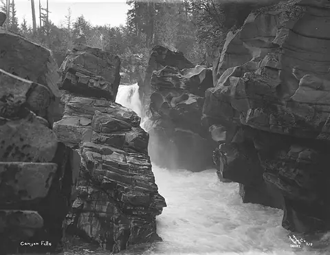
  • Canyon Falls

    about 42 ft · about 1.6 miles southeast of Index

  • Deer Falls

    about 14 miles northeast of Index

  • Eagle Falls

    about 2.6 miles southeast of Index

  • Feature Show Falls

    about 259 ft · about 5.3 miles southeast of Oso

  • Marsh Creek Falls

    about 89 ft · about 4.3 miles north of Sultan

  • McCoy Creek Falls

    about 58 ft · about 2.1 miles southwest of Sultan

  • Sunset Falls

    about 104 ft · about 1.2 miles south of Index

  • Bald Eagle Falls

    about 18 miles northeast of Index

  • Blanca Lake Falls

    about 12 miles northeast of Index

  • Boulder Drop

    about 2.1 miles west of Index

  • Boulder Falls

    about 4.8 miles southeast of Oso

  • Bridal Veil Falls

    about 2.3 miles south of Index

  • Bridal Veil Falls-Lower East Cascade

    about 2.2 miles south of Index

  • Bridal Veil Falls-Mine Cascade

    about 1,291 ft · about 2.3 miles south of Index

  • Bridal Veil Falls-Upper Cascade

    about 2.5 miles south of Index

  • Buck Creek Falls

    about 14 miles east of Verlot

  • Explorer Falls

    about 50 ft · about 2.7 miles east of Lake Roesiger

  • Gibson Falls

    about 13 miles east of Darrington

  • Granite Falls

    in Canyon Creek

  • Logjam Falls

    about 2.5 miles south of Index

  • Lower North Fork Falls

    about 67 ft · about 16 miles southeast of Darrington

  • Lower Twin Falls

    about 236 ft · about 5.2 miles south of Verlot

  • Lower Wallace Falls

    about 2.1 miles northeast of Gold Bar

  • Mackintosh Falls

    about 266 ft · about 17 miles northeast of Index

  • Marckworth Falls

    about 4.4 miles south of Sultan

  • Mary Pamela Falls

    about 5.4 miles east of Lake Roesiger

  • Meditation Falls

    about 92 ft · about 5.5 miles southwest of Swede Heaven

  • Middle Wallace Falls

    about 367 ft · about 2.3 miles northeast of Gold Bar

  • North Fork Falls

    about 16 miles southeast of Darrington

  • North Fork Sauk Falls

    about 58 ft · about 16 miles southeast of Darrington

  • Olney Falls

    about 59 ft · about 1.9 miles northwest of Gold Bar

  • Ozimandias Falls

    about 33 ft · about 6.1 miles south of Sultan

  • Perry Creek Falls

    about 14 miles southeast of Darrington

  • Pride Basin Falls

    about 299 ft · about 15 miles northeast of Index

  • Pride Glacier Falls

    about 407 ft · about 15 miles northeast of Index

  • Small Falls

    about 1.2 miles northeast of Gold Bar

  • Sunday Falls

    about 14 miles northeast of Index

  • Twin Falls

    about 138 ft · about 5.1 miles south of Verlot

  • Upper Olney Falls

    about 26 ft · about 2.3 miles north of Gold Bar

  • Upper Wallace Falls

    about 240 ft · about 2.5 miles northeast of Gold Bar

  • Wallace Falls

    about 2.3 miles northeast of Gold Bar

  • Weeping Wall Falls

    about 17 miles northeast of Index

  • Youngs Creek Falls

    about 26 ft · about 4.5 miles south of Sultan