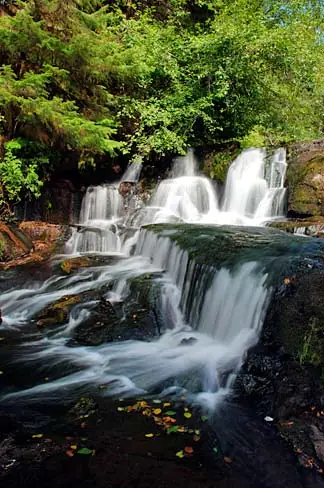
Waterfalls near Eugene, Oregon
There are 44 named waterfalls within 50 miles of Eugene, Oregon. The closest is Siuslaw Falls, about 18.6 miles away.
Updated November 2026. Distances are straight-line from the town center; the drive is longer.
Use my location instead
Best-known falls within 50 miles
The 40 closest named falls
-
Siuslaw Falls
18.6 mi · Lane County · about 13 miles south of Veneta
-
Waters of Mormon
23.6 mi · Benton County · about 2.5 miles west of Alpine
-
26.2 mi · Benton County · about 6.4 miles west of Alpine
-
Green Peak Falls
26.8 mi · Benton County · about 5.9 miles southeast of Alsea
-
Wildwood Falls
28.8 mi · Lane County · about 14 miles southeast of Cottage Grove
-
Brice Creek Falls
28.8 mi · Lane County · about 13 ft · about 14 miles southeast of Cottage Grove
-
Chichester Falls
29.5 mi · Lane County · about 13 miles east of Lowell
-
Spirit Falls
32.7 mi · Lane County · about 7.2 miles west of Westfir
-
The Horn
33.3 mi · Lane County · about 4.3 miles northeast of Mapleton
-
Moon Falls
33.6 mi · Lane County · about 5.6 miles west of Westfir
-
Pinard Falls
34.7 mi · Lane County · about 6.5 miles southwest of Westfir
-
Upper Kentucky Falls
35.1 mi · Douglas County · about 289 ft · about 7.8 miles southeast of Mapleton
-
Royal Terrace Falls
35.5 mi · Linn County · about 4.2 miles north of Sweet Home
-
Lower Kentucky Falls
35.8 mi · Douglas County · about 384 ft · about 7.5 miles south of Mapleton
-
North Fork Falls
35.8 mi · Douglas County · about 410 ft · about 7.4 miles south of Mapleton
-
Majestic Falls
36 mi · Linn County · about 4.6 miles north of Sweet Home
-
Upper Trestle Creek Falls
36.4 mi · Lane County · about 10 miles southwest of Westfir
-
Lower Trestle Creek Falls
36.5 mi · Lane County · about 11 miles southwest of Westfir
-
Fall Creek Falls
38.5 mi · Lincoln County · about 7.1 miles west of Alsea
-
Smith Falls
38.7 mi · Lane County · about 12 miles southwest of Westfir
-
Lower Parker Falls
38.7 mi · Lane County · about 9.9 miles southwest of Westfir
-
Upper Parker Falls
38.7 mi · Lane County · about 9.7 miles southwest of Westfir
-
Rainbow Falls
39 mi · Linn County · about 2.1 miles southeast of Cascadia
-
Beaver Creek Falls
39.3 mi · Lane County · about 6.5 miles south of Mapleton
-
Smith River Falls
39.5 mi · Douglas County · about 16 miles northeast of Reedsport
-
Homestead Falls
39.5 mi · Lane County · about 5.7 miles south of Mapleton
-
Punchbowl Canyon Falls
39.6 mi · Lane County · about 5.8 miles south of Mapleton
-
Elk Wallow Falls
39.6 mi · Lane County · about 6 miles south of Mapleton
-
Annice Falls
39.6 mi · Lane County · about 5.8 miles south of Mapleton
-
Sweet Creek Falls
39.7 mi · Lane County · about 6.3 miles south of Mapleton
-
Lower Soda Falls
40 mi · Linn County · about 1.7 miles northeast of Cascadia
-
Upper Soda Falls
40.5 mi · Linn County · about 2.1 miles northeast of Cascadia
-
Cascade Falls
40.7 mi · Lincoln County · about 12 miles east of Yachats
-
Moose Creek Falls
41.3 mi · Linn County · about 3.2 miles east of Cascadia
-
Grouse Mountain Falls
42.1 mi · Lane County · about 14 miles southwest of Westfir
-
Salmon Falls
42.3 mi · Lane County · about 4.7 miles east of Oakridge
-
Salmon Creek Falls
42.3 mi · Lane County · about 4.7 miles east of Oakridge
-
Salt Creek Falls
42.4 mi · Lane County · about 4.8 miles east of Oakridge
-
Devil's Staircase
43.5 mi · Douglas County · about 13 miles east of Reedsport
-
Rider Creek Falls
43.9 mi · Lane County · about 26 miles northeast of Oakridge
4 more named falls are within 50 miles. The county lists below include them.
County lists and nearby towns